
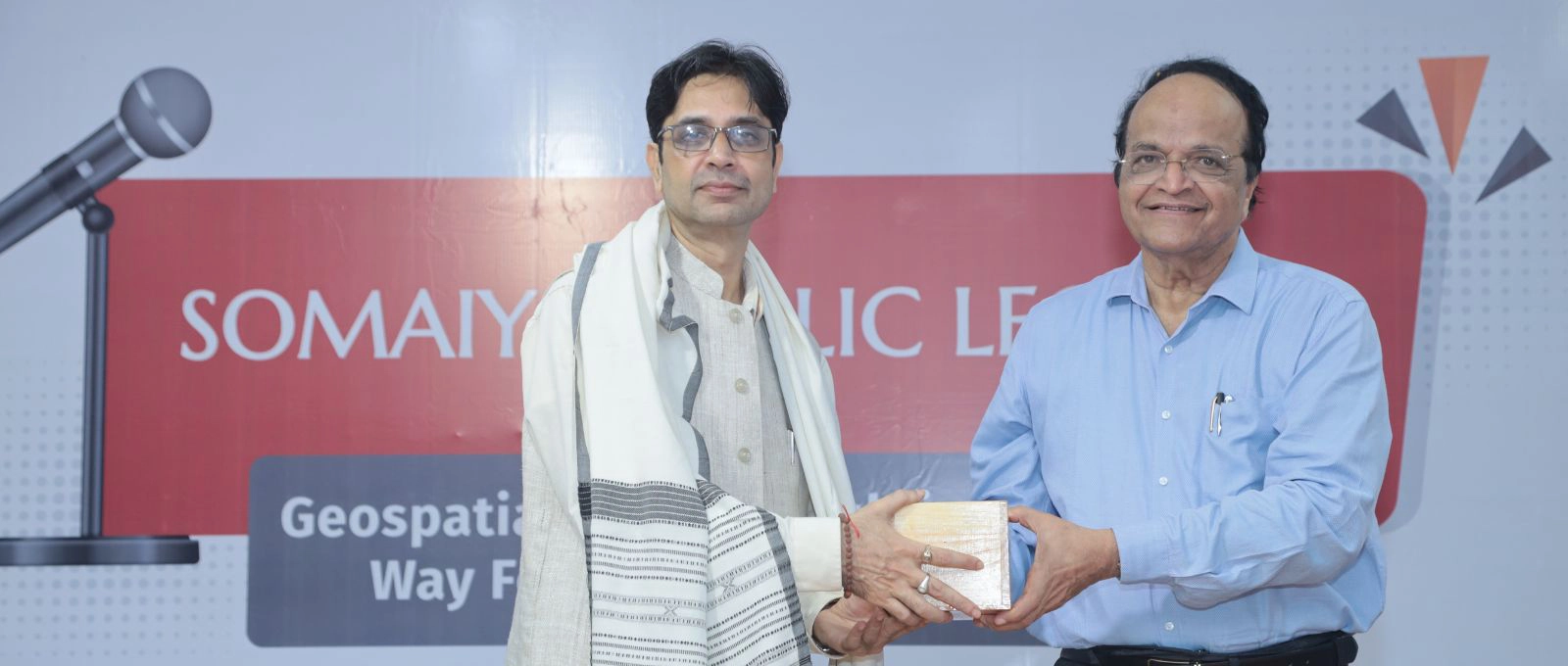
The Somaiya Public Lecture titled “Geospatial Data for the Public Good and Way Forward as a Consortium” was held on 7th October 2025 in the K J Somaiya Institute of Technology (KJSIT) auditorium, Powai. The lecture was delivered by Dr Surya Durbha, Head of the Centre of Studies in Resources Engineering (CSRE), IIT Bombay.
Dr Vivek Sunnapwar, Principal of KJSIT, warmly welcomed Dr Durbha and expressed his gratitude to Hon’ble Vice Chancellor Dr V N Rajashekharan Pillai for initiating the Somaiya Public Lecture series. In his address, Dr Pillai applauded the organisers for their efforts and underscored the importance of such knowledge-sharing sessions. He encouraged students to engage with experts not only from their own disciplines but also from diverse fields to broaden their perspective. Dr Pillai then felicitated Dr Durbha with a token of appreciation.
Prof Vricha Chavan, the organiser and anchor for the event, introduced Dr Durbha, highlighting his academic accomplishments and contributions to the field of geospatial science.
Dr Durbha’s lecture offered an insightful exploration into Geospatial Technology and its real-world applications. Using vivid satellite images of varying resolutions and regions, he demonstrated how this technology helps analyse urban development, environmental changes, and disaster impact assessments. He began with multispectral images of Mumbai, illustrating how satellite data captures the city’s urban growth over the years.
He went on to show how a night-time image of India during Diwali can reveal patterns of electricity consumption across states, and how change detection techniques assist in assessing disasters like the tsunamis in Indonesia and Japan. He also touched upon recent earthquakes in Nepal and Israel, explaining how satellite imagery enables accurate infrastructure loss assessments.
Dr Durbha elaborated on the significance of microwave, SAR, LIDAR, and ensemble imaging, and their roles in applications such as precision agriculture, groundwater studies, irrigation management, soil moisture analysis, and agricultural insurance through NDVI (Normalised Difference Vegetation Index) calculations.
As Chairman of the Consortium of Geomatics in India, he highlighted the importance of collaboration and interoperability in advancing national and global geospatial standards. He encouraged students to engage with large-scale national projects like FASAL II, using geospatial data to drive societal and environmental good.
The lecture concluded with an engaging question-and-answer session, where students and faculty interacted actively with Dr Durbha.

Leave a Comment